Wednesday, June 29, 2011

Kings River Falls

On Father's Day, we decided to take a little hike. The weather was actually cloudy and a bit cool when we left our house, so I was a little nervous we would drive and then get rained out. I had been wanting to combine a hike with a little waterplay, so I thought Kings River Falls would be a good place to explore. I have seen it listed in several hiking books and a swimming hole book. It was time to check it out ourselves. I wish I could tell you directions to get there. It was not easy, and I would have you ending up in another state. I will say if you head to Huntsville, then head out of town, it is that direction. It was a LOT of driving on very rocky dirt roads too. Just when you think you won't ever get there, there is the trailhead. The books all say that is only 1.2 miles long, round trip. My husband and I don't agree with that but I have no evidence to tell you otherwise. I wish I had worn my pedometer. It was more walking than I had planned on. It is also listed as an easy hike. I don't know if I totally agree with that either. It wasn't difficult or overly hilly. But it wasn't smooth sailing either. It is a very rocky trail and there were some slight inclines. I was fairly worried about twisted ankles. But then I have been on tougher; I wasn't overly out of breath at any point. I would call it a moderate easy. :) Here is the only sign that there is a trail. The trail is not very wide and is surrounded by really tall weeds. I would do a tick check after leaving there. And watch for slithery creatures...
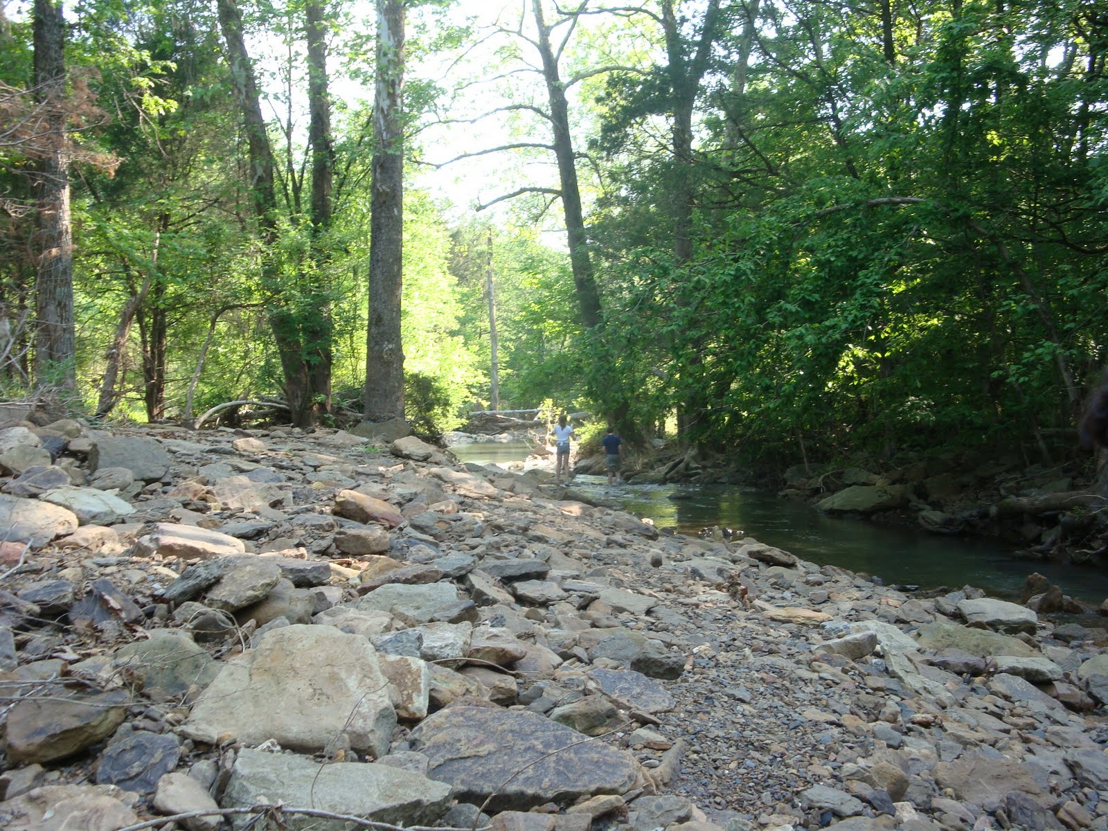
The first part of the trail you are walking along the edge of a field (private property) on one side, a creek (which was pretty dry) on the other.
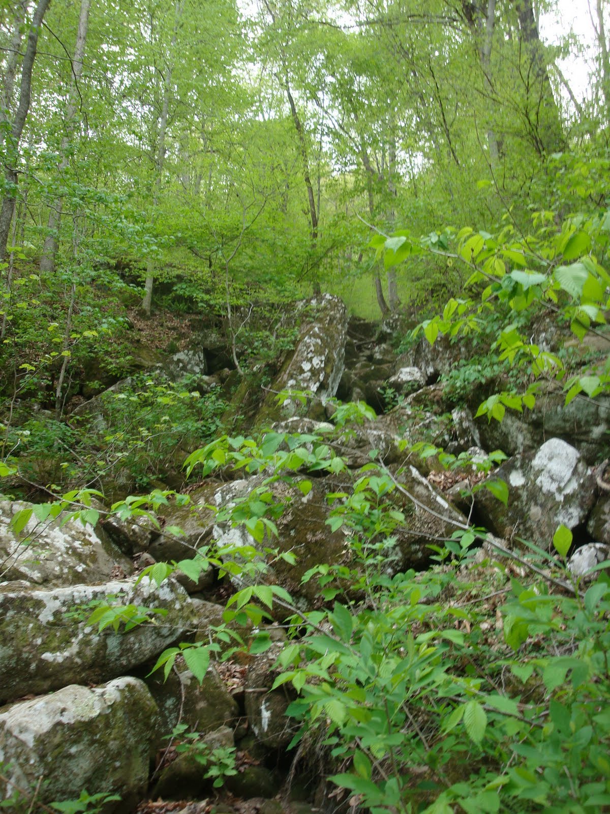
At one point, you come across a rock wall between you and the field. Apparently the wall is from a long time ago. I wonder how much time it took to build it?
There were also some pretty bluffs (not very big) in the area. Then finally you come to the waterhole and the "falls". From pictures I have seen, the water was VERY low this visit due to lack of rain in the area. But there was still a nice little area to swim. I think the waterfall is typically much wider.There were some nice little bluffs to jump from. If you jumped toward the center, the water was deep enough to not break any bones. :) Oh, the water was a bit chilly but that didn't stop my kids from jumping in repeatedly.
It wasn't the biggest swimming hole but it was quite popular. By the time we left, there were several people there swimming, jumping, laying in the sun, and exploring.

I knew with woods and water and warm weather, seeing a snake was a very real possibility. Sure enough, there was one (and supposedly another) swimming in the swimming hole too. It was just a water snake that tried to stay away from people as much as possible. I also saw a really large black snake along the trail on the way out. However, as soon as it heard us, it slithered away as quickly as possible.
One of the sights on the way back to the car. It was more beautiful than the picture shows.
Walking along the creek...
A neat little bridge to cross (which probably comes in handy when there is more water flowing).
Overall, it was a fun little hike (just longer than we expected). I would love to go back after a really good rainfall. My kids thoroughly enjoyed it and have already asked to return. We would probably frequent it more often if it were a bit closer and not such a bumpy ride. But I have a feeling we will be going back. In terms of kid safety, it was very safe. No dangerous spots during the hike. Just be careful at the swimming hole/waterfall (or any body of water). The water does get deep pretty quickly.

Happy hiking!
Reba

Wednesday, May 11, 2011

Crack in Rock

For Mother's Day, my request was to take a walk in the woods with my family. After church and lunch, we headed out the door and down the road to Van Buren to the Lee Creek Reservoir. I had read about a trail called Crack in Rock (sometimes called Split Rock). I think it is about a mile and a half long.

It was a warm day but this was a good trail for that. The creek runs next to the trail, so the kids had some waterplay. I am very thankful that we saw no snakes. We saw raccoon and deer tracks, several birds, crawfish, and ticks (ick). But nothing slithering in the water...

Anyway, the reservoir recreation has three trails I think. Two of them start at the same place...to the right of the restrooms.

The trails are clearly marked though which helped.

After all of the train, there was a pretty nice creek flowing and everything was green, green, green. And there were LOTS of ticks. We did a thorough check later. One of my kids found one the next day (crawling around). Other than that, I loved this trail.
My kids spent a LONG time wading in the creek. It was obvious there had been some flooding but thankfully most of it had gone down. And it wasn't flowing too terribly fast. The water was very clear which helped.

Here is a picture partway down the trail where the water was a little deeper.

One of the things I enjoyed was the variety of plant life. For instance, there were patches of cactus plants everywhere...
This is the top of the waterfall. I am sure there is a way to the base to get a better look but we stuck to the trail this time.
Lots of beautiful green
There were short bluffs along the creek...never ceases to amaze me at how beautiful they are!
We kept saying, "Did we miss the Crack in Rock?" Then we went around a curve and saw this...Bingo!

The scenery was beautiful the whole trail. The trail does loop, so you end up back at the creek when you finish.
A marker (some were on trees)
Beautiful
I would rate this trail pretty easy. There was one real incline in it that had me huffing and puffing, but overall it was fairly flat, lots of views/scenery, and just the right length for my little people...

Now I am ready to go back and explore some more!

Reba

Monday, April 18, 2011

Lost Valley

Sad note/update:
Due to torrential rains this past rain which lead to some serious flooding, the trail at Lost Valley is closed until further notice.

On Sunday afternoon, I was in the mood for a hiking adventure. Out next two weekends are kind of busy, and I was afraid we would miss that "good weather" window for hiking. Mark had some church obligations at home, and Joshua needed a nap. The other two seemed content being at home. So I asked Maria to join me. Down the road we went...

We went to a waterfall I will blog about soon but it was a very short hike. So we headed over to Lost Valley. Lost Valley is right outside of Ponca near the Buffalo River. It is a 2 mile trail. I would rate it moderate. We went a year ago, and had I blogged about it the past few months, I would have listed it as easy. Apparently in all of the excitement, I had forgotten certain things like the gazillion steps you walk up to get to some of the higher points...

The start of the trail is very easy and stroller friendly (if you need that). It is a wide path and fairly flat.
I was so happy to see how green everything was. I was getting a little distressed on our recent hikes...there hasn't been much green. Apparently our heavy rains in the last week helped a lot. It was like the world came alive. I needed that this weekend.
The first part of the trail is like I said...fairly flat and wide. It is like a beautiful stroll in the woods. We did constantly watch for snakes since I have seen more than one picture of a copperhead hanging out in Lost Valley. Thankfully, we didn't see any.
One thing we did see...butterflies. They were everywhere. We counted them for a while but lost count eventually. There were a lot of these (I know no butterfly names) plus some other kinds. I think God knew my heart needed that too...butterflies always lift my spirit.
The creek wasn't as full as I thought it would be with our recent rains, but there was some water flowing.
This is the point we picked up the pace...we started "climbing" on rock steps from this point on. I still feel it in my thighs...

We decided to check out "Natural Bridge" first which was just right off this path.
I have to admit, I never see a natural bridge. I just see this "waterfall" which is actually one part of a waterfall...it is like it is in phases.
Okay, maybe this is the "natural bridge".
I really wish I knew more about flowers. These were so pretty and not a flower I typically see on hikes.
Beautiful. It was all just beautiful.
There is the middle section of the water fall. It is rather high and was flowing well.
Here is a look at the waterfall from above. At this point, we were climbing the steps to the cave. Part of the waterfall is actually INSIDE the cave. I went in there last time but didn't this time. It is a TIGHT squeeze (think "commando crawl") and very dark. So even being in there, I could hear the waterfall but couldn't really see it. We just climbed to the entrance this time which is a hike in itself. If there is any dangerous part at all, this is it. It is a fairly narrow climb up. I know people have fallen but I think there was horseplay involved...
On our way back down, we had to stop by the waterfall one more time.
Just think green...
I almost stepped on this "green leaf" which turned out to be a moth.
This trail loops. It is shaped like a needle. The first part of the path "in" is also the path out. But partway in, you loop around until you are back at that main path heading out. Make sense?
Saw these feathers on our way out. I don't think this bird had a happy ending but the feathers were beautiful.
It really is a neat hike. Other than some climbing (walking up numerous steps) and that one danger area by the cave, it is a very family friendly hike. I recommend it for beginner hikers (in good shape :).

A bonus? If you leave the trail close to sunset, you might catch a glimpse of the elk that live in the area. They are a popular tourist sight.

Happy hiking!
Reba

Sunday, April 10, 2011

Lost Bridge by Beaver Lake

It was a warm day yesterday, but after not getting out for a hike last week due to circumstances, we decided to head out anyway. I was in the mood to try something new, so we drove over to Lost Bridge after reading a little about it.

Lost Bridge is over by Beaver Lake. If you take 62 out of Rogers like you are driving to Eureka Springs, take a right on 127 in Garfield. You will drive this very curvy road for about six miles. At one point, you will come to a fork. Take the left (the 127s) and turn in at Lost Bridge. There will be signs for the marina.

Warning: This is one of the few times we paid to hike. It cost 4 dollars for our car. That is for a day use fee. We didn't realize it would cost but thankfully had some money on us.

After you enter the park, drive down toward the marina. When you can see the marina straight ahead, look for a hiking sign on the right like the one below. Park beside it.

We saw different lengths for this trail. Most of what I read said it is a five mile trail, though the sign at the trail said 7 miles. We knew we weren't going to make the whole route with our three year old plus the heat, so we just chose to start here and head back when needed. I think we only walked about a mile and a half of the trail (which was three miles round trip...pushing it with the three year old) and still didn't make it to the "highlights" of the trail. I want to go back and see those some day. But the walk was still a lot of fun.
The part we walked was right on the edge of the lake the whole time which just added to the beauty. We had woods on one side, lake on the other.
I don't know why the rock formations continue to awe me but they do. I am just always astounded to see these huge rocks just lying there in the middle of the woods. The kids wanted to "climb" but we knew we were pushing it with time. Maybe next time.
At one point, we were very close to the lake, so we decided to stop and play there for a bit. One of the kids' favorite parts were the shells. They were everywhere. I used to go to the lake with my grandfather to go fishing and had forgotten how prevalent shells were.
This is looking toward the marina. It was such a beautiful day. I was really surprised there wasn't more boat traffic going on.
This is looking the other direction at the cove...

I would classify this hike as moderate (and possibly strenuous since I didn't do the whole thing). There were definite areas of incline. I was huffing and puffing a few times and did count it as my exercise for the day!
More rock formations
The trail was fairly well defined. It did "snake" quite a bit adding to the length of at least what we hiked.
I guess I expected more to be in bloom at this point. The trees are just starting to bud. Not a lot of green out there. But there were some pretty trees...
This was a fun little area. It was like a mini bluff, a rock shelf, etc. It was a fun place to hang out (and climb).
This was just about the point we turned around. If Joshua hadn't been so tired, we would have gone on because there were some overlooks/bluffs ahead. Of course, that would have involved climbing which I am not sure I was up for at that point. :) There is also an old homestead (or remnants of) on this trail but it was a few miles down the trail.
We had fun watching the geese hanging out on the boat docks. They were noisy. Thankfully, other than some butterflies, bees, ants, fish, and geese, we didn't see any other nature (a.k.a. snakes).
Overall it was a fun trail, though the weather was a bit warm. It was longer than what our little one can handle at this point but I definitely want to go back. Anytime we can have water, woods, and rocks, we have a fun time!

It was a safe trail...at least the parts we hiked. I am guessing you would have to be careful by the bluffs but we didn't make it to that part.

Happy hiking!
Reba